We had been at an overnight free camp just 5km from the border to beat the daily rush.
Photo by our travelling friends Toni and Dave who followed us through quarantine and covid pass checks. No queue and no hassles
KUNUNURRA, the first town over the border, a great place to stock up on groceries and do any repairs after the WA Gibb River Road. It is a great place to meet up with those coming from the West to get pointers and tips and to help those heading East with similar info....a real good cross over meeting place
Photos do not do the colours justice, nor show the height of gorges, or express how hot the days are which have been averaging 33° Celsius by 10am, so I will choose only a couple of photos for each place.


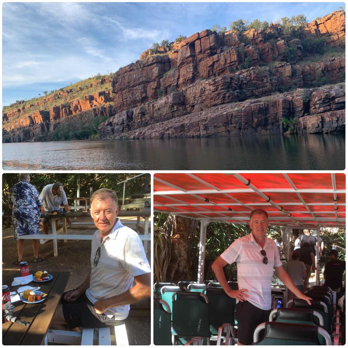
Kununurra was founded in the 1960s with the damming of the Ord River in 2 places to form a 55km long lake, plus Lake Argyle at the top, to irrigate the surrounding plains. We did a return boat cruise on the river up to Lake Argyle Dam, spotted 36 freshies, and explored a few of the overflow creeks. It was the best way to appreciate the Ord.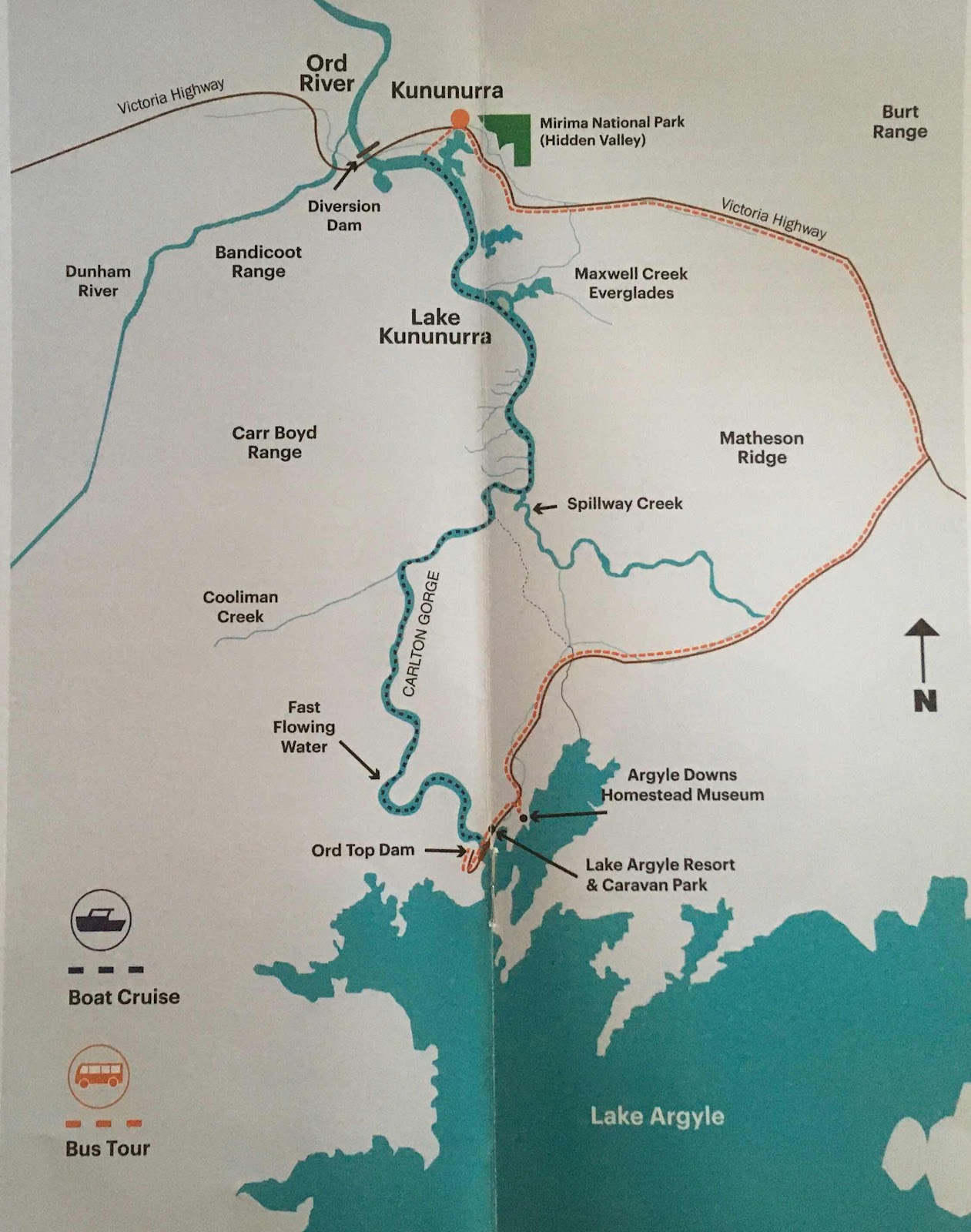
The scenery changed every 2 minutes as we followed the Carr Boyd Ranges upstream


Afghan Cemetery. Afghan cameleers played a huge roll in the outback during the pioneering days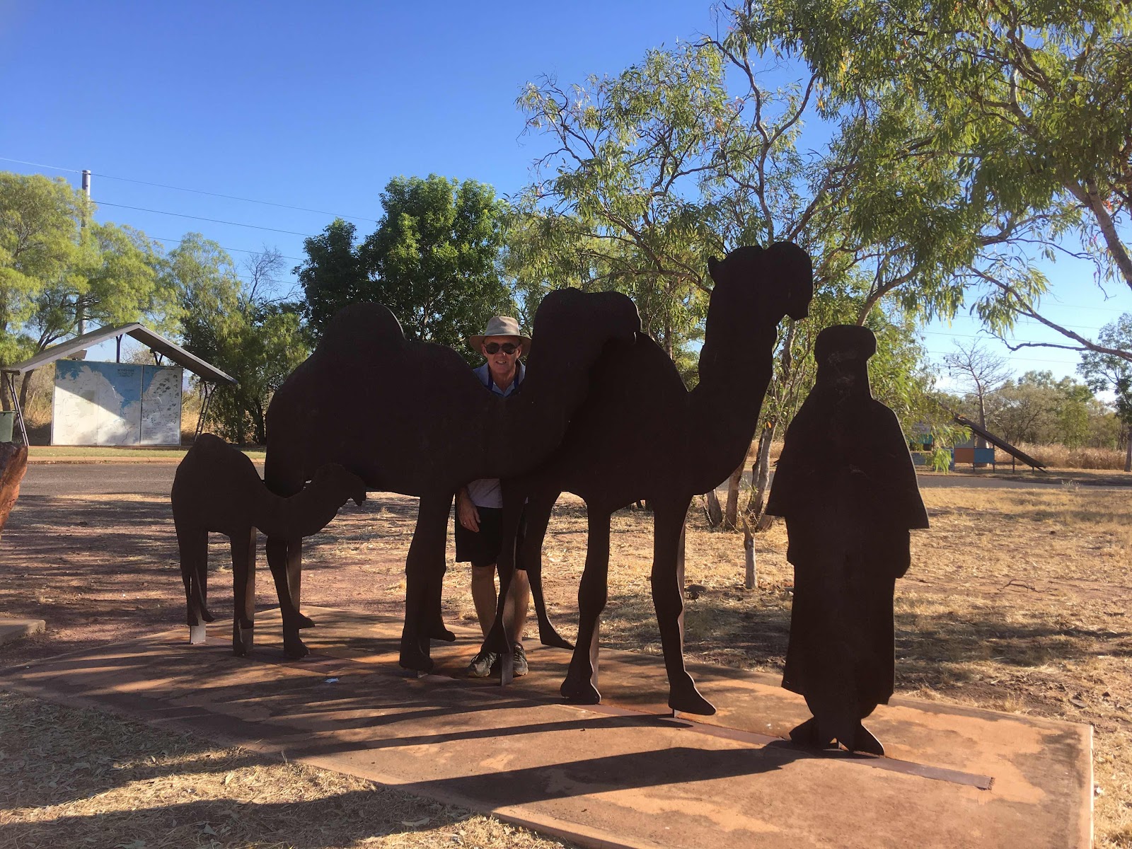


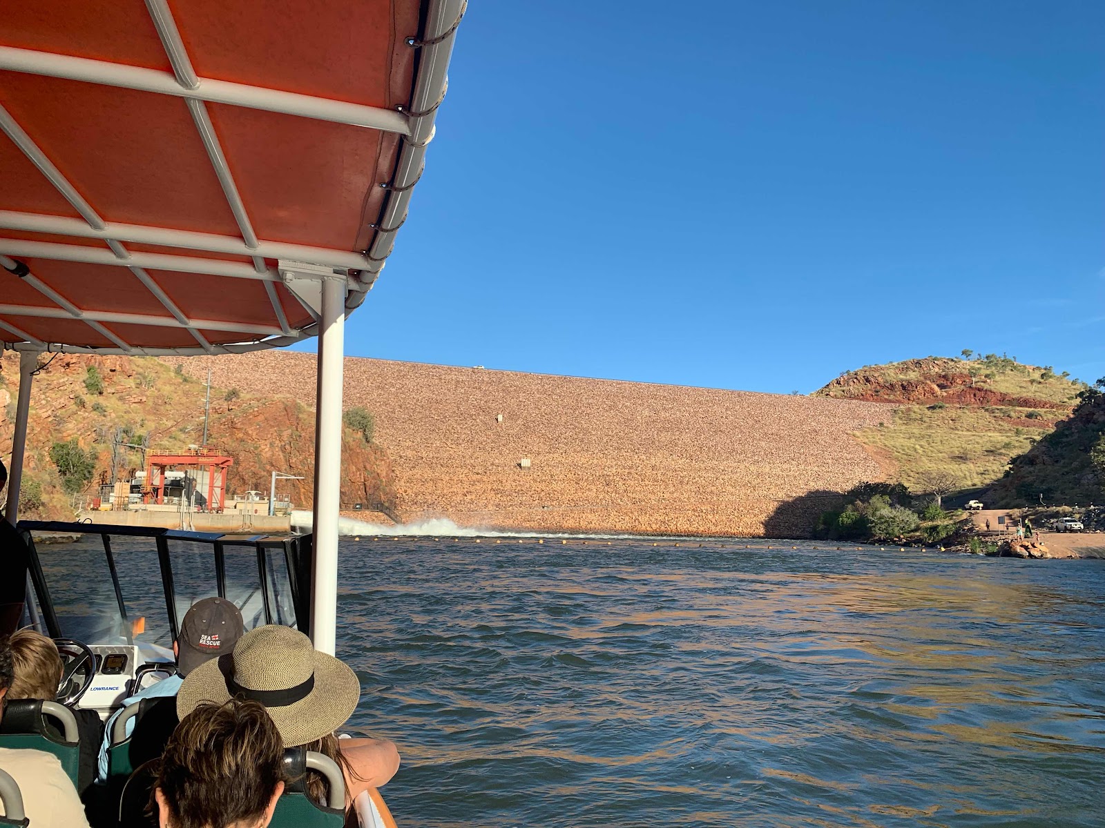
Lake Argyle and dam is a 45 minute drive from Kununurra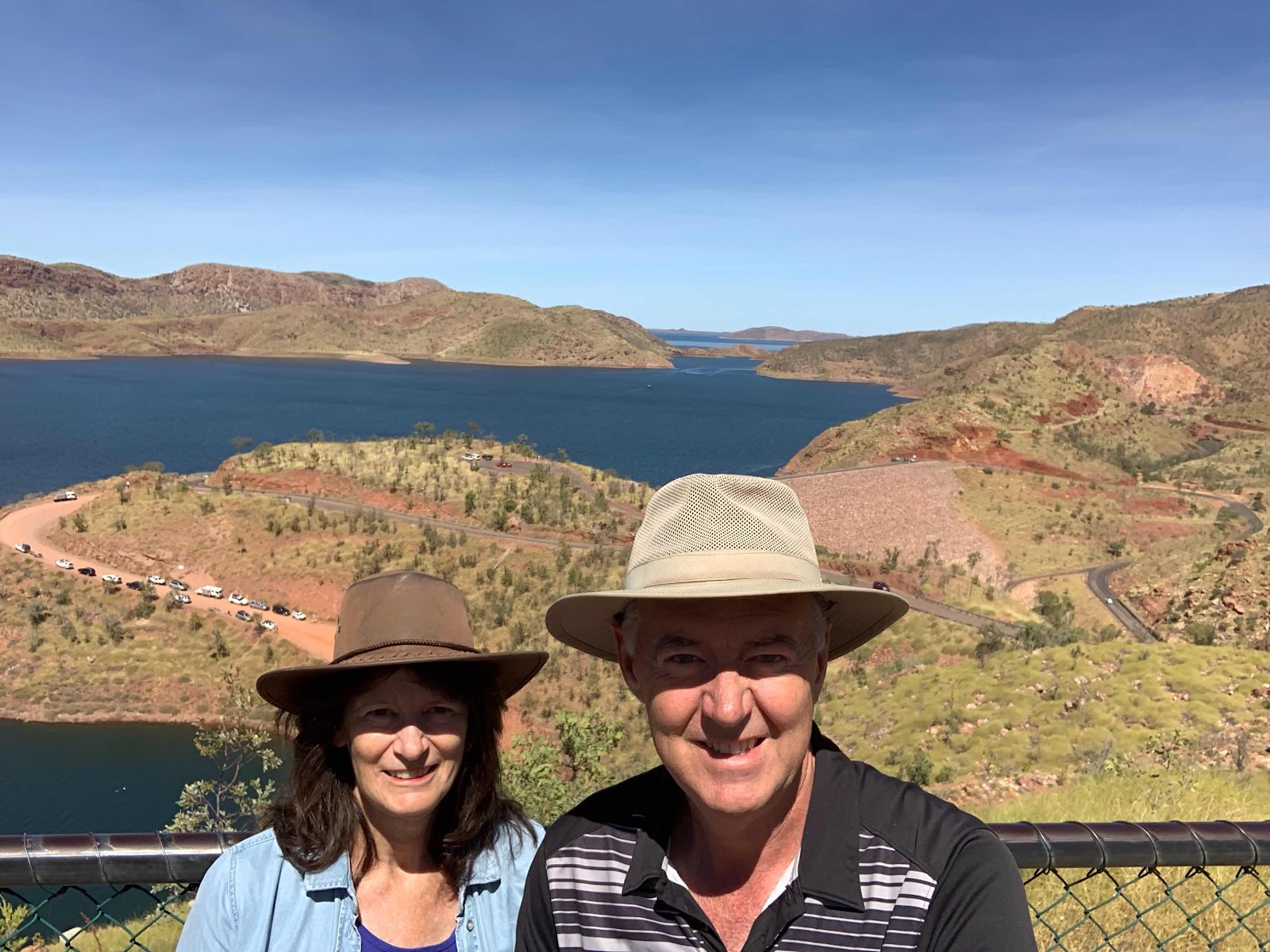

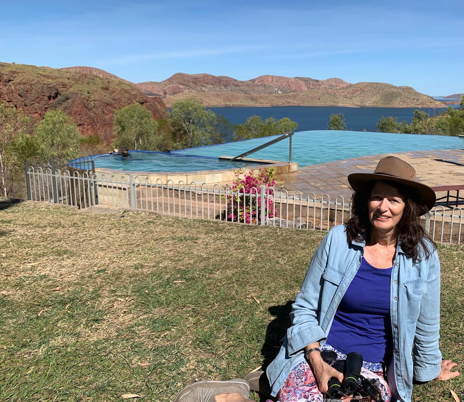
This is the closest we got to the famous infinity pool, too cold for us, we are clever at getting photos without the multitude of tourists in them 😆
The Durack’s pioneer home was relocated to avoid being flooded by the dam, now a museum


Ivanhoe Crossing, a nice spot for lunch and then a visit to the Sandalwood factory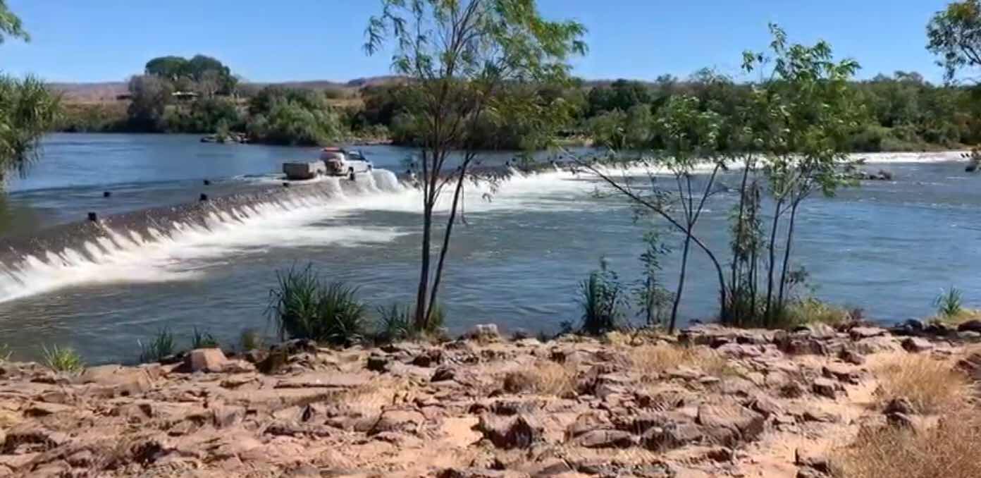
Diversion Dam near town, 55 km downstream from Lake Argyle, it is probably the only place on the A1 highway around Australia where the highway goes a long the top of a dam wall

The Grotto, to get down to the bottom of this waterfall gorge you have to take the steep 140 sandstone/cement stairs that zig zag down the face/wall of the gorge, hard to see from the ground
Derek took this photo from half way down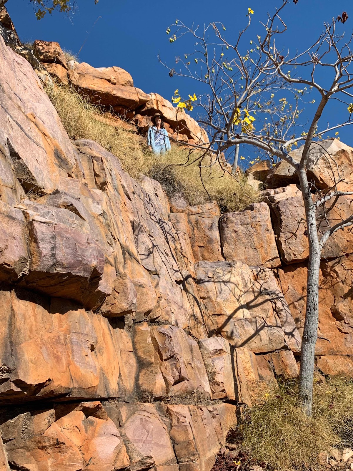
The waterfall at the end was dry, and at 8.30am, still too cold for us to swim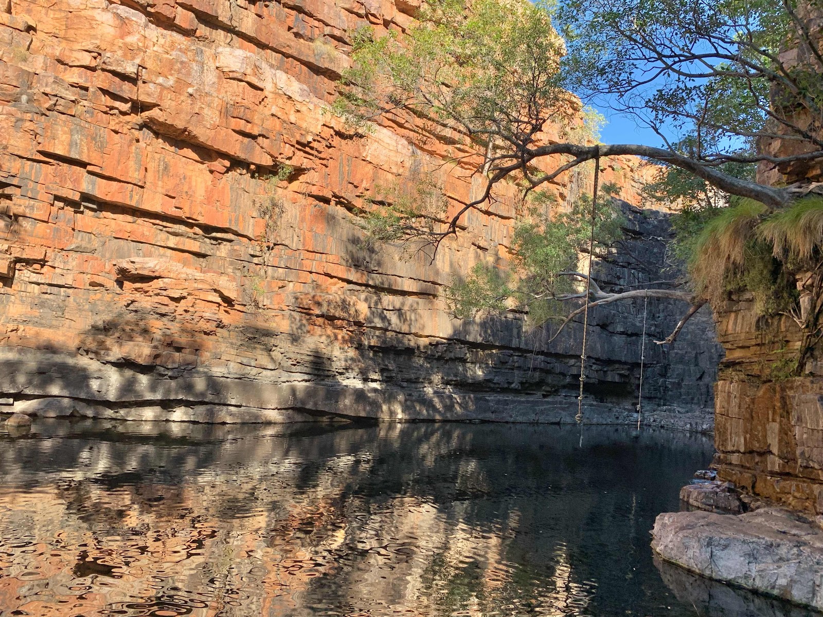
Fascinating trees hanging on to the cliff

Parrys Nature Reserve, great Marlgu Billabong bird hide,
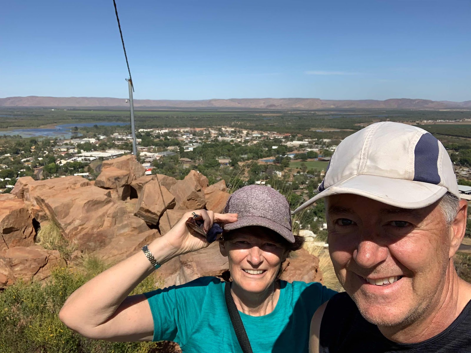
View from Telegraph Hill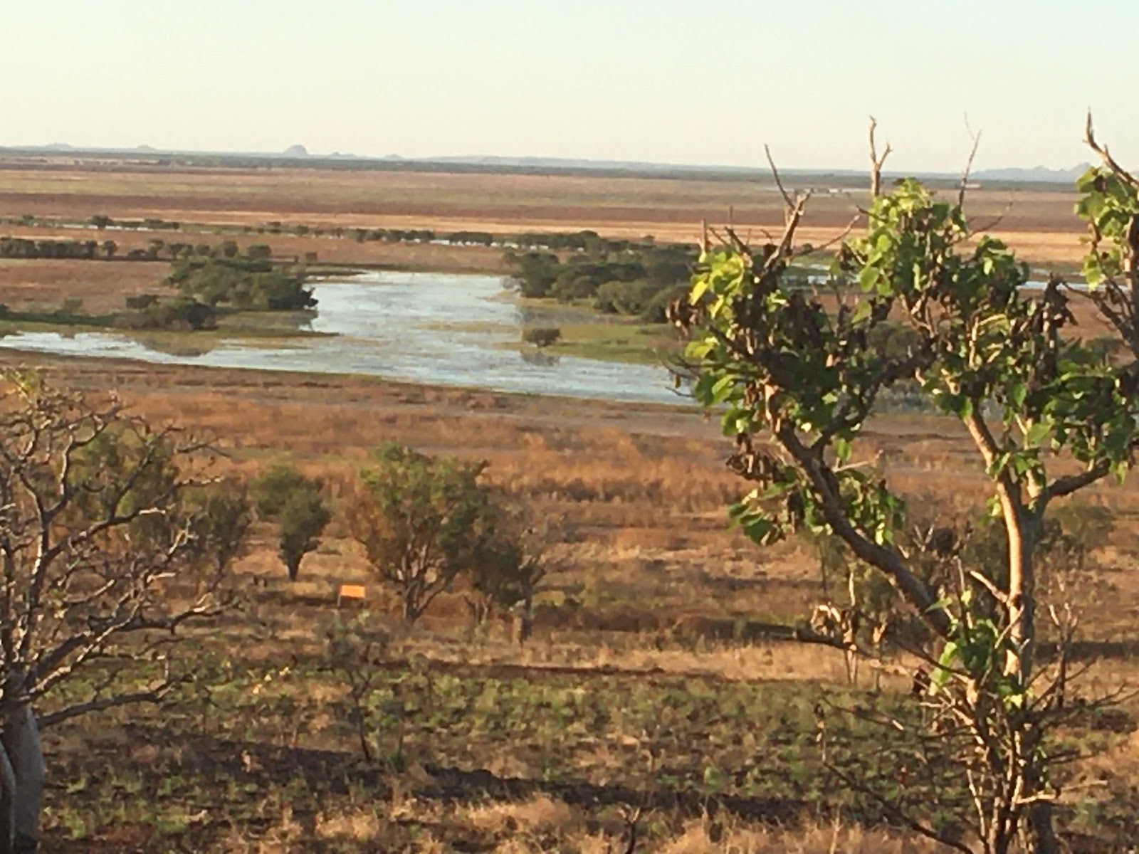
Remains of the old Telegraph Station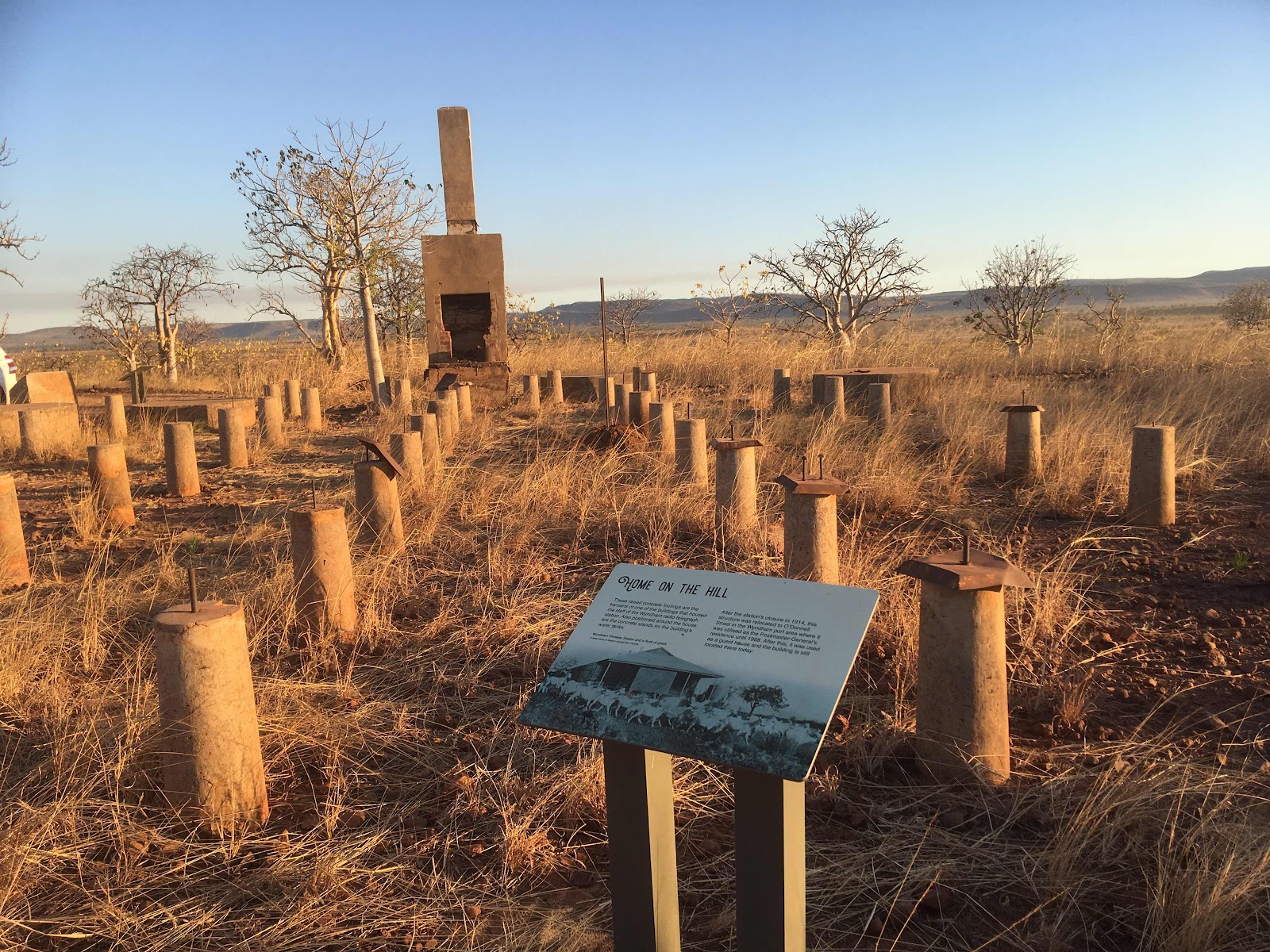
Local scenery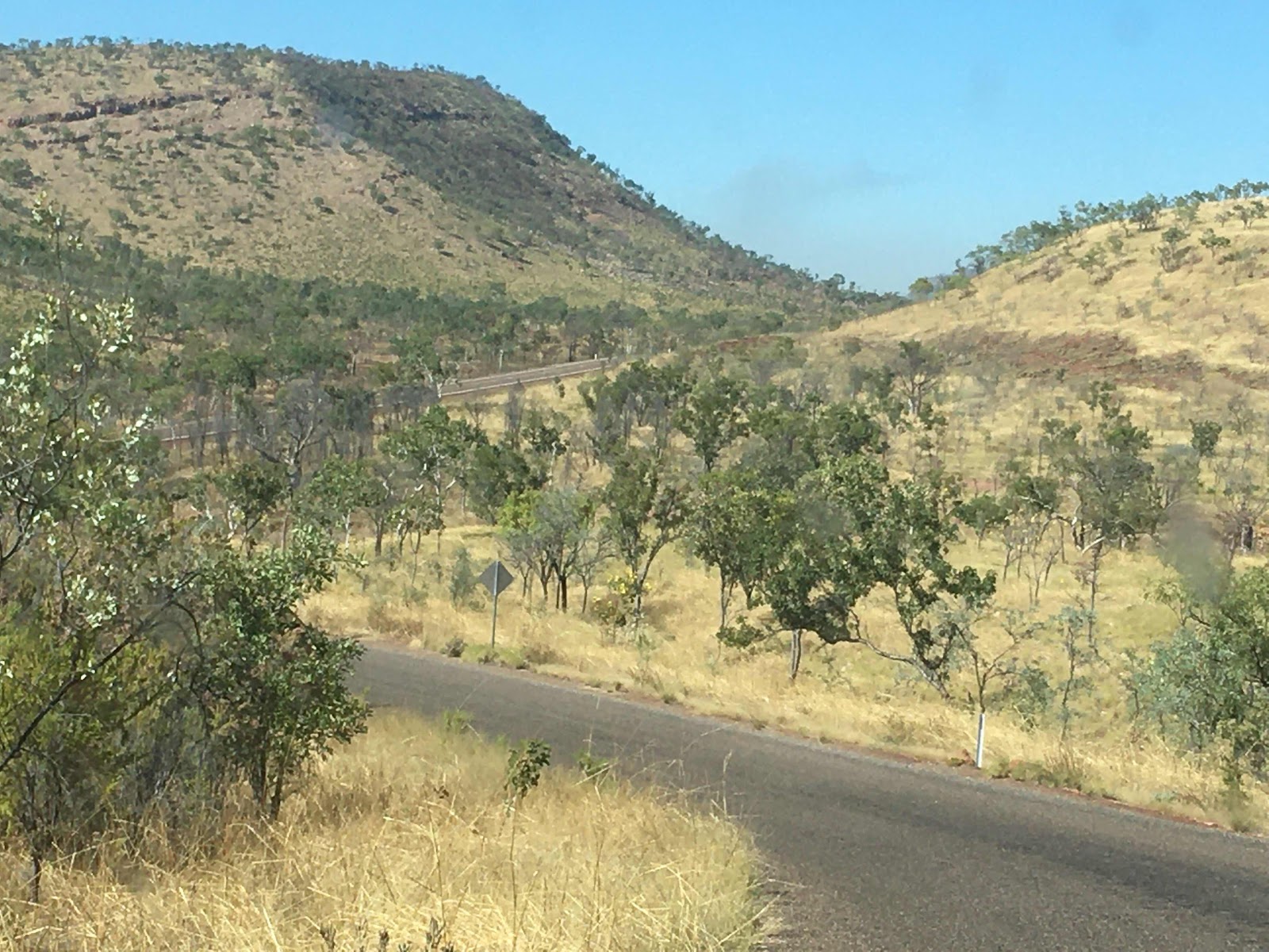
Many local spot fires too, burning the tall savannah spinnifex grass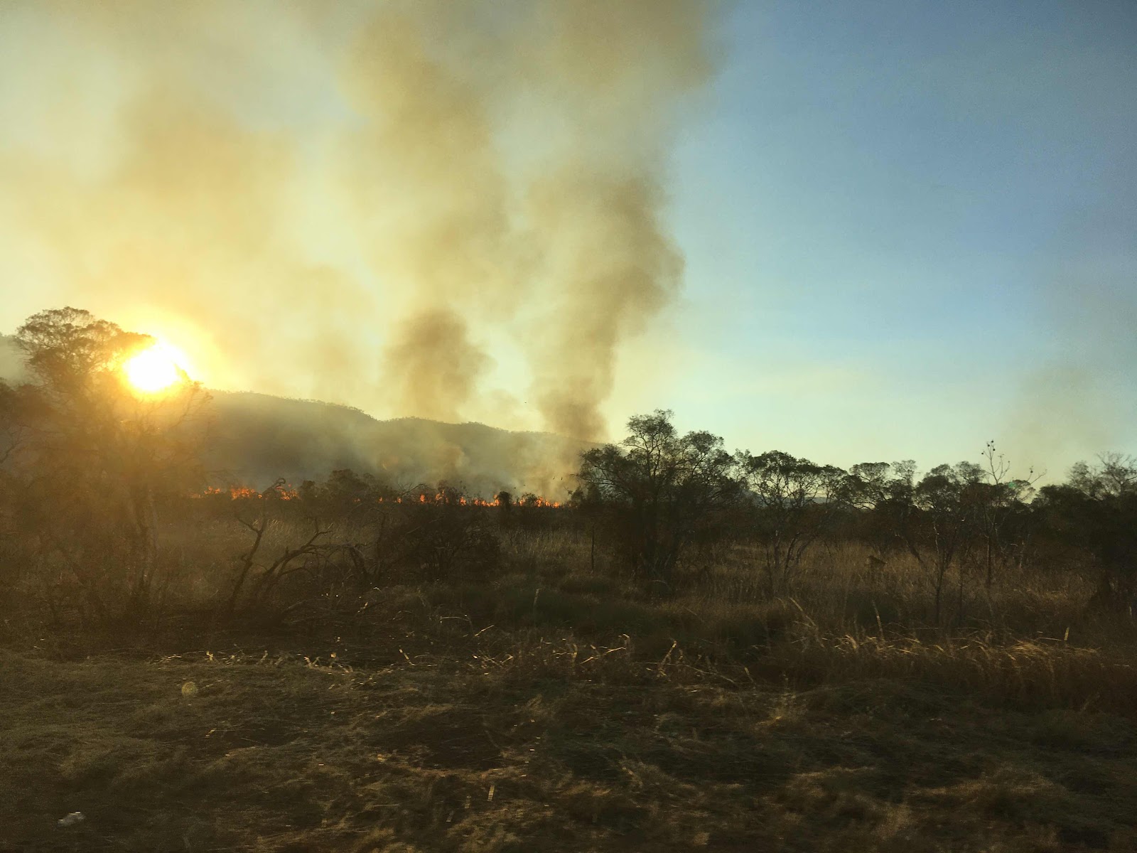
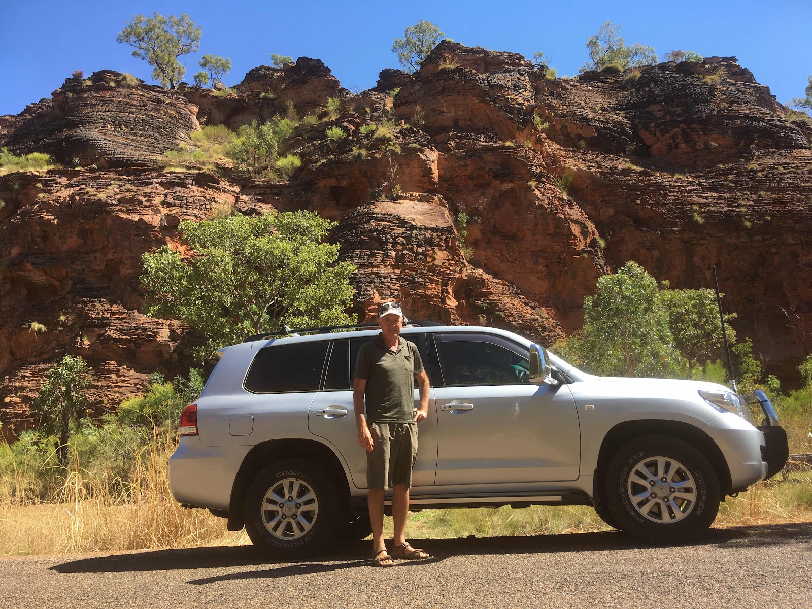
El Questro Station...start of the Gibb River Road, rough corrugated short cut to Derby, we will meet up again with it at the other end after taking the long way round on bitumen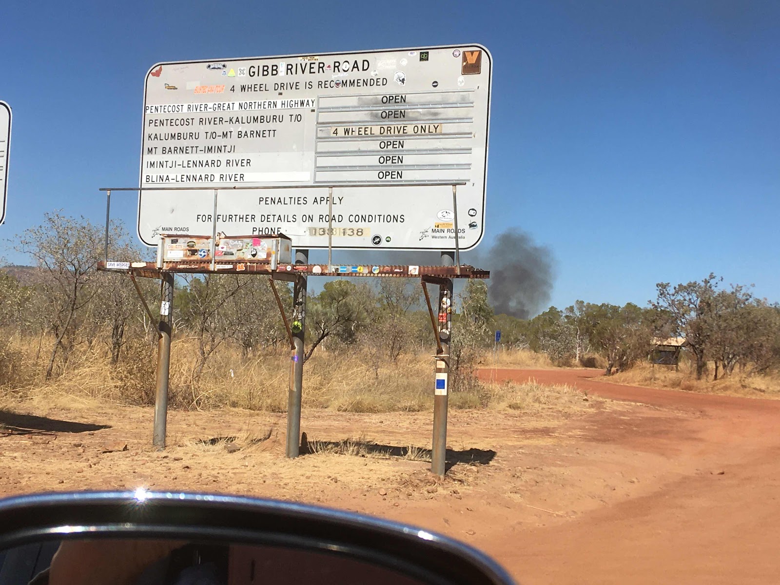
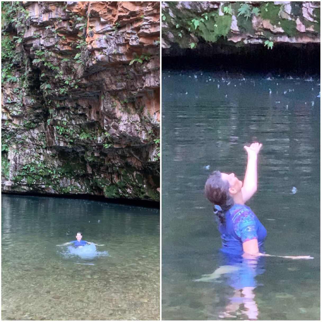
Emma Gorge EQ, beautiful 3.2km return hike through a rugged narrow gorge to an epic swimming hole, we deserved a swim even though the water was freezing, but there was a hot spring to the right which was man made with rocks into a small hot spa, just what we needed to bring our body temp back to normal. A well deserved icecream awaited us back at the kiosk.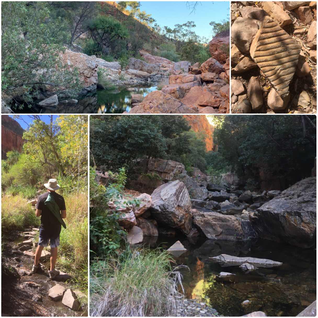


KUNUNURRA, the first town over the border, a great place to stock up on groceries and do any repairs after the WA Gibb River Road. It is a great place to meet up with those coming from the West to get pointers and tips and to help those heading East with similar info....a real good cross over meeting place
It was impossible to get into one of the 6 caravan parks without a booking, all booked out, so we queued at the Showgrounds in Kununurra to see if anyone was leaving that day (they do not prebook sites). We were in luck and stayed for a week, and then extended a further 5 nights, as there is so much to see in and around Kununurra. It is a seasonal town where people come in their thousands to escape southern winters, to cross the top end of Australia in the dry season and to fish for Barrumundi
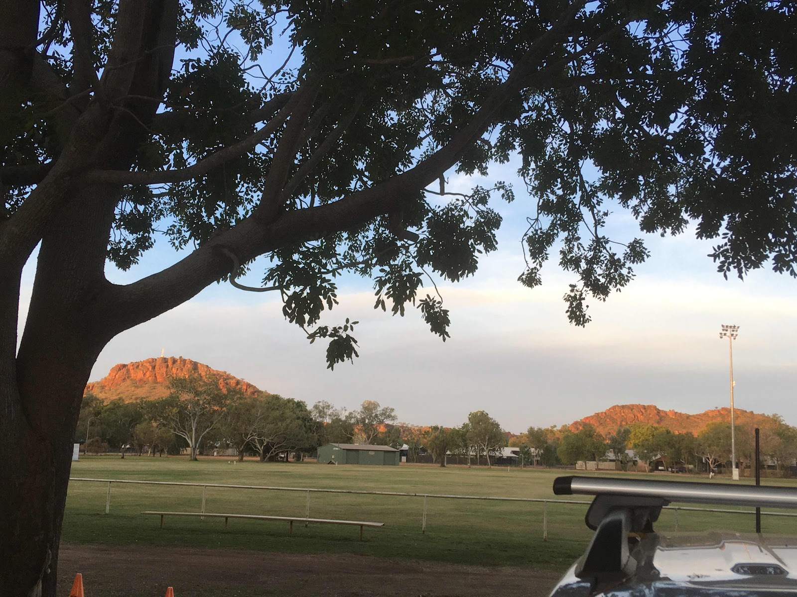
View across to the National Park and Kellys Knob, beautiful colours at sunset each day
Photos do not do the colours justice, nor show the height of gorges, or express how hot the days are which have been averaging 33° Celsius by 10am, so I will choose only a couple of photos for each place.
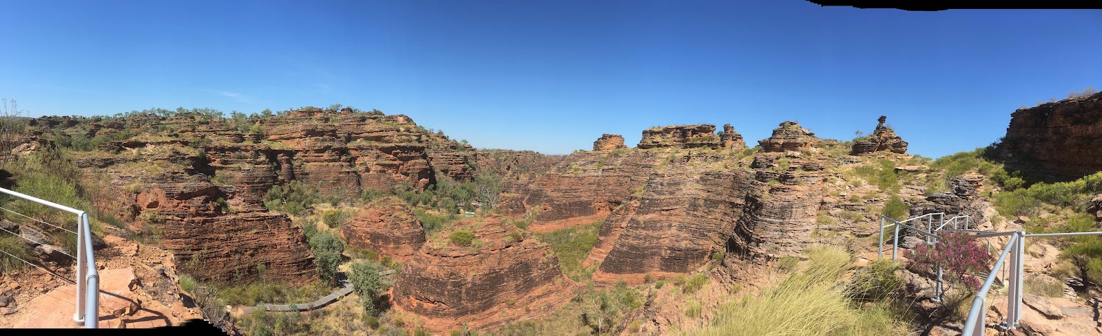
After settling in we explored Mirima the local National National Park, also known as a mini Bungle Bungles
Kununurra was founded in the 1960s with the damming of the Ord River in 2 places to form a 55km long lake, plus Lake Argyle at the top, to irrigate the surrounding plains. We did a return boat cruise on the river up to Lake Argyle Dam, spotted 36 freshies, and explored a few of the overflow creeks. It was the best way to appreciate the Ord.
The scenery changed every 2 minutes as we followed the Carr Boyd Ranges upstream
We went ashore to a small camp for afternoon tea
The dam wall
The crocs sunbathed on the rocks and also amongst the reeds in the side creeks
Back in time for sunset (total of 5 1/2 hours cruising the Ord)
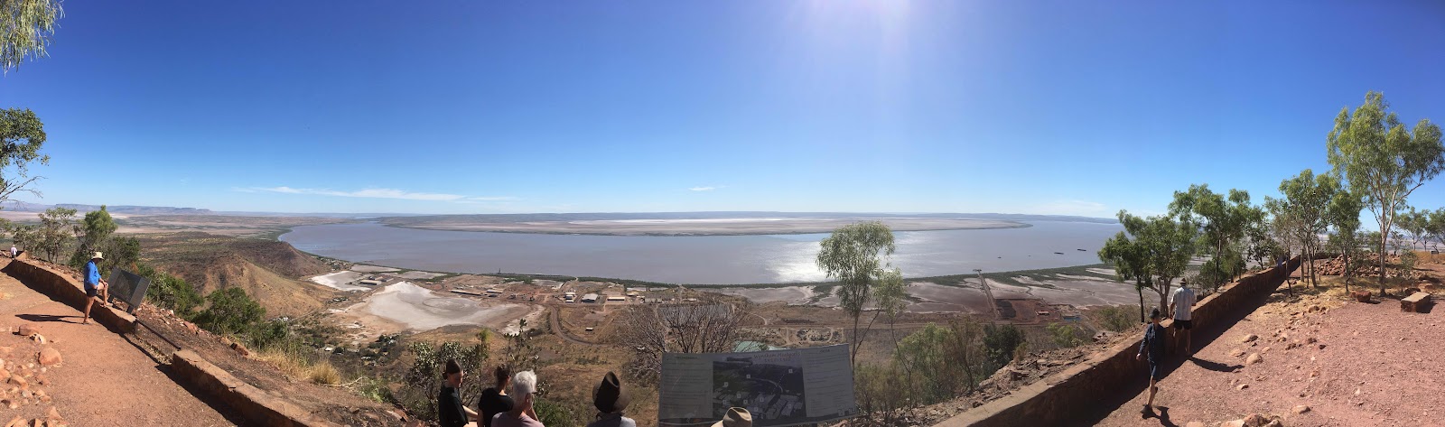
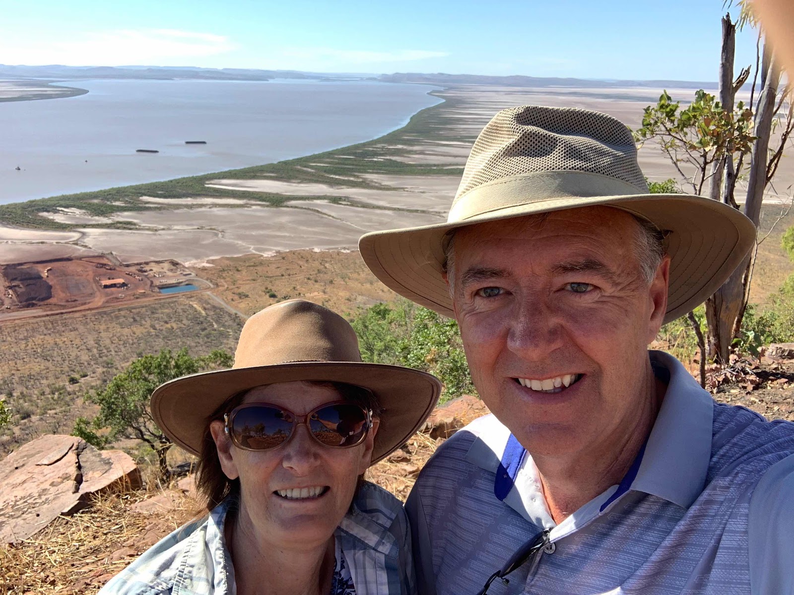
Wyndham, or the Port of Wyndham is the historical area for this part of the Kimberleys. It lies on a gulf and the junction of 5 rivers including the Ord. Cattle were the original export from this region since 1882 when the Durack family drove overland 7250 cattle and 200 horses from NSW Goulburn through their 2,500,000 acre property at Coopers Ck in Qld up to 2,500,000 acres here on the Ord River, a trek of which took 2 years and 4 months to cover 4828 km. It was Patrick Durack’s dream to harness the mighty Ord River which flowed like a torrent in the wet season, then dried out to a series of water holes during the dry hot winters.
5 Rivers Lookout.... a saltpan delta system, the port is now exporting iron ore
Afghan Cemetery. Afghan cameleers played a huge roll in the outback during the pioneering days
The age at death in the pioneer cemetery could not come close to these ages
Lake Argyle and dam is a 45 minute drive from Kununurra
This is the closest we got to the famous infinity pool, too cold for us, we are clever at getting photos without the multitude of tourists in them 😆
The Durack’s pioneer home was relocated to avoid being flooded by the dam, now a museum
These 2 local bower birds up here decorate with white, silver and green, if the lady bower bird is not impressed, he starts all over again
Ivanhoe Crossing, a nice spot for lunch and then a visit to the Sandalwood factory
Kellys Knob, a morning walk and climb to the top tower with views over town and Lake Kununurra
Diversion Dam near town, 55 km downstream from Lake Argyle, it is probably the only place on the A1 highway around Australia where the highway goes a long the top of a dam wall
The Grotto, to get down to the bottom of this waterfall gorge you have to take the steep 140 sandstone/cement stairs that zig zag down the face/wall of the gorge, hard to see from the ground
Derek took this photo from half way down
The waterfall at the end was dry, and at 8.30am, still too cold for us to swim
Fascinating trees hanging on to the cliff
Parrys Nature Reserve, great Marlgu Billabong bird hide,
View from Telegraph Hill
Remains of the old Telegraph Station
Local scenery
Many local spot fires too, burning the tall savannah spinnifex grass
El Questro Station...start of the Gibb River Road, rough corrugated short cut to Derby, we will meet up again with it at the other end after taking the long way round on bitumen
Emma Gorge EQ, beautiful 3.2km return hike through a rugged narrow gorge to an epic swimming hole, we deserved a swim even though the water was freezing, but there was a hot spring to the right which was man made with rocks into a small hot spa, just what we needed to bring our body temp back to normal. A well deserved icecream awaited us back at the kiosk.
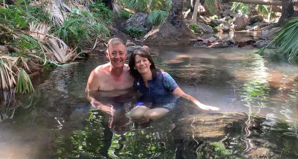
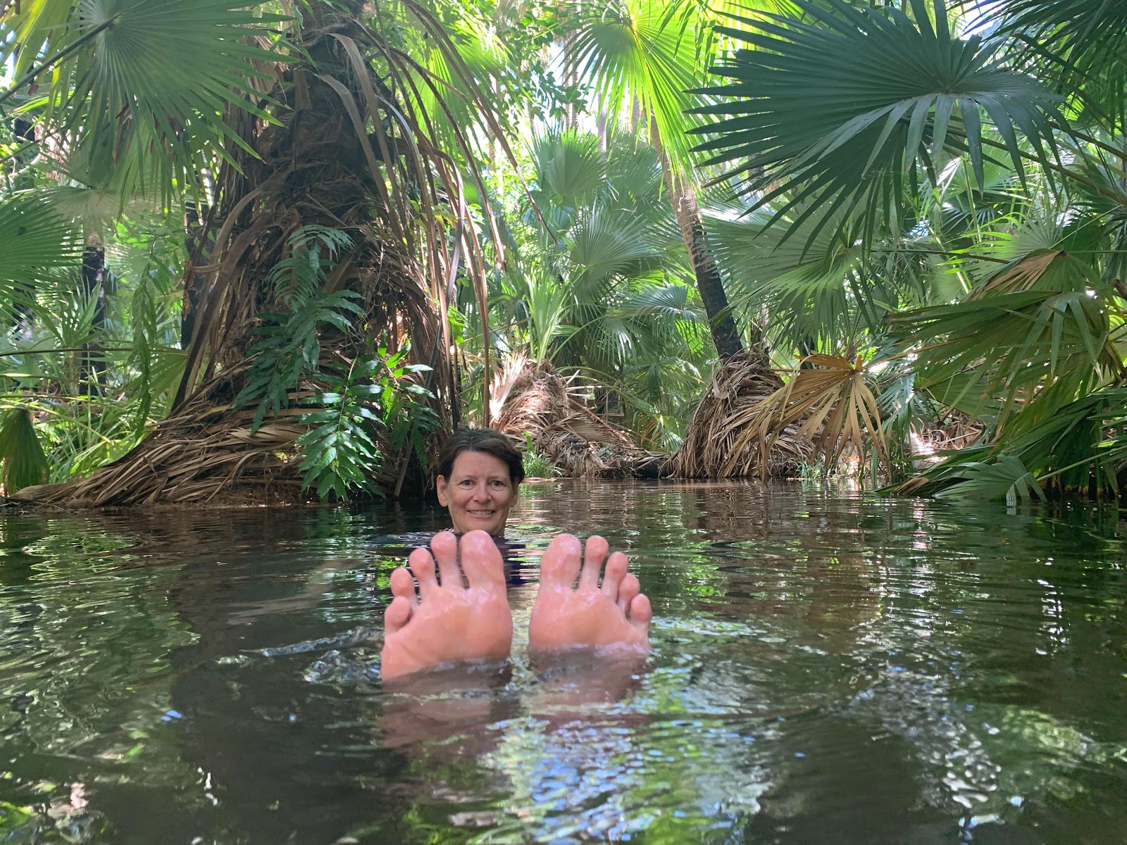
Zebedee Springs at EQ, so tropical, and loved the hot thermal spring
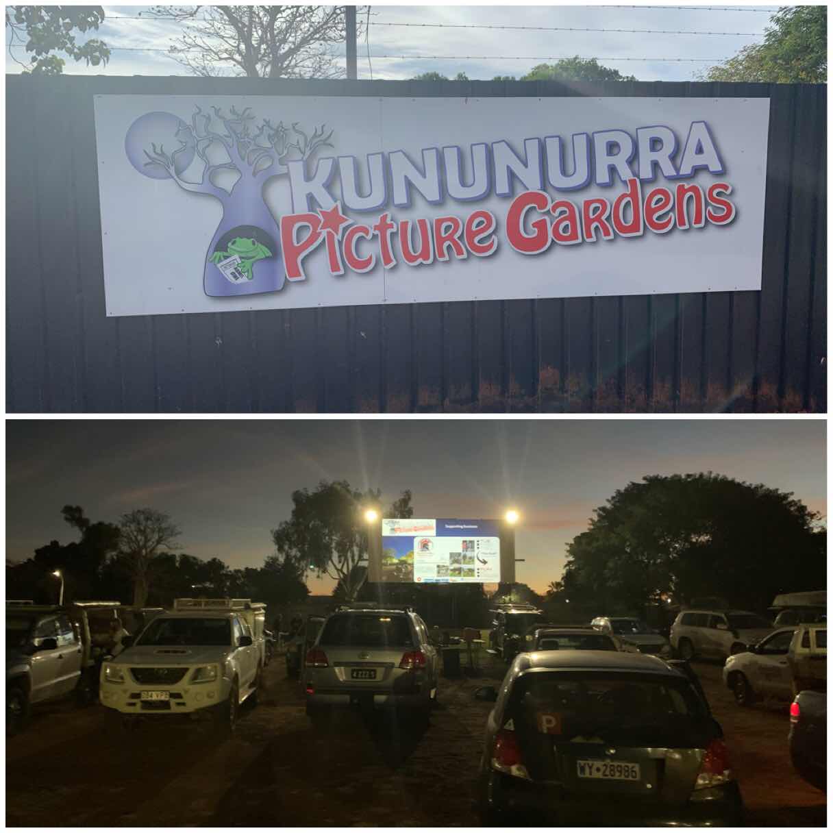
Drive In Movie..Fast and Furious 9, we can’t remember the last time we went to a drive in movie
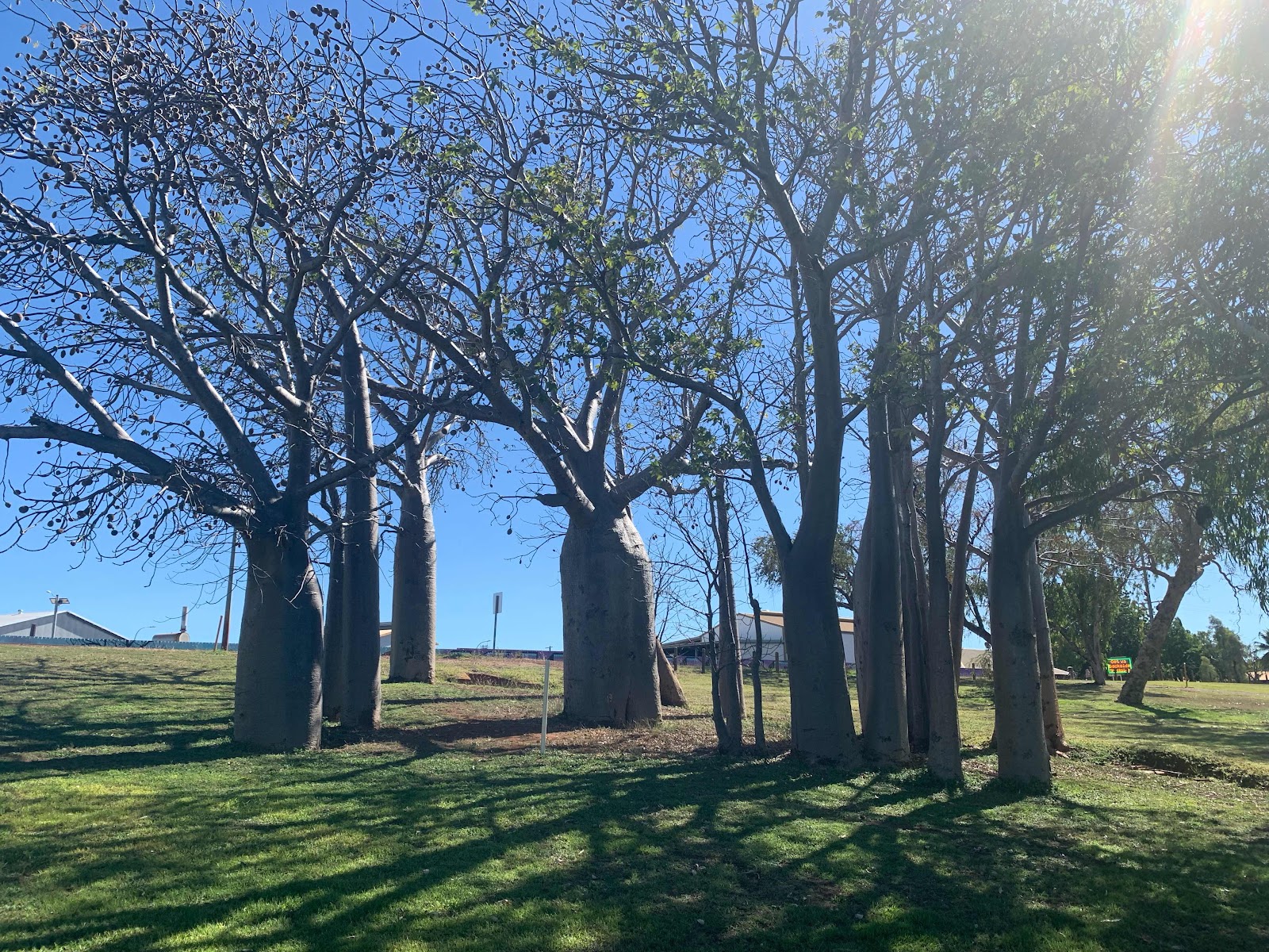
Boab Tree (Gregorii) only native to this region of Australia are fascinating and some are up to 1500 years old

Quite often you see a grove, the parent boab and the offspring
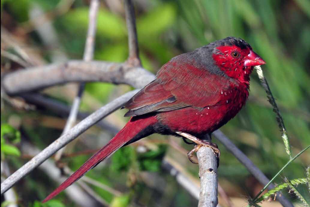
Bird of the week Crimson Finch, the beautifully coloured Gouldian finch was nowhere to be seen
We leave tomorrow for a camping adventure with the tent at the Bungle Bungles.